NOAA-21 VIIRS NCC Imagery Available in AWIPS via SBN
This summer 2023, NOAA-21 VIIRS Near-Constant Contrast (NCC) imagery has become available for National Weather Service (NWS) users to access in the Advanced Weather Interactive Processing System – II (AWIPS-II) via the Satellite Broadcast Network (SBN). With the addition of NOAA-21 VIIRS NCC, users can now access the nighttime visible imagery from three JPSS polar-orbiting satellites: Suomi-National Polar-orbiting Partnership (S-NPP), NOAA-20 and NOAA-21.
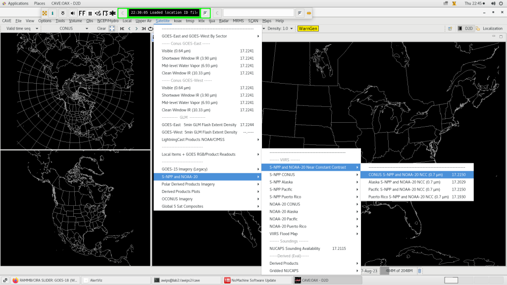
Refer to the screenshot below that shows how users can access CONUS VIIRS NCC imagery from all three satellites in AWIPS-II. In AWIPS, simply click on the ‘Satellite’ tab, scroll down to ‘SNPP and NOAA-20’, then to ‘S-NPP and NOAA-20 Near Constant Contrast’, and select ‘CONUS S-NPP and NOAA-20 NCC (0.7 um)’. Be aware that the AWIPS menu entries are not updated with the NOAA-21 VIIRS NCC menus. The current menu configurations are planned to be updated in the next TOWR-S RPM release, v24, tentatively scheduled for later this fall (~October 2023). However, users can update the NOAA-21 menu entries manually from the TOWR-S instructions that are described here. The instructions also provide details on how to fix an overlap issue that may be seen between VIIRS satellite swaths. Note, per TOWR-S, the current menu configuration may not be applicable for other regions (e.g., Alaska sector) who receive VIIRS imagery from Direct Broadcast (DB).

The animation below displays the VIIRS NCC imagery from all 3 satellites over CONUS during the overnight hours on 17 August 2023. The imagery is shown during the new moon phase of the lunar cycle. Notice how NOAA-21 VIIRS NCC imagery is placed in between NOAA-20 and SNPP VIIRS NCC imagery by 1/4 orbit (~25 minutes apart).
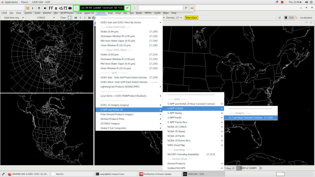
Over the CONUS sector, there is an additional way to access NOAA-21 VIIRS NCC imagery in the AWIPS menu. Users can click on the Satellite tab, scroll down to ‘SNPP and NOAA-20’, then to ‘S-NPP CONUS’ and select ‘0.7 um Near Constant Contrast’ (see the image below). For now, SNPP and NOAA-21 VIIRS imagery can be accessed here as well, however, the menu configurations will be updated in the future by TOWR-S RPM v24.

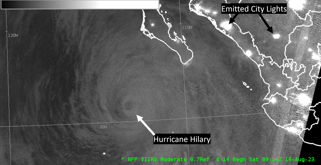
An AWIPS VIIRS NCC example from NOAA-21 observes the eye and areal extent of Hurricane Hilary. At ~0914Z, 19 August 2023, the hurricane was located southwest of the Baja California Peninsula. The hurricane proceeded to move into Southern California the next day and produced significant precipitation totals over the region.

