Super Typhoon Jelawat
Dan Bikos
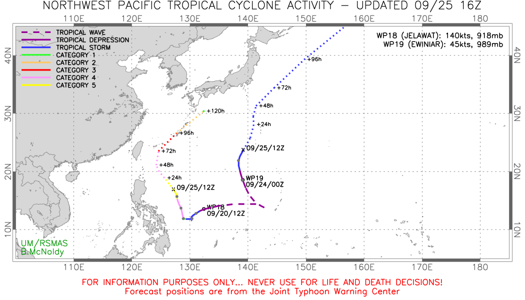
Typhoon Jelawat developed in the Phillippine Sea of the western Pacific Ocean around September 20, 2012. See the westernmost track of the figure below:
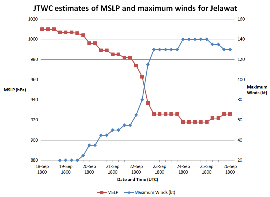
As the cyclone began turning towards the north / northwest while it was east of the Philippines, it went through rapid intensification. In order to address the rapid intensification, we will consider estimates of MSLP and maximum winds associated with Jelawat from 2 different sources. First, we’ll consider the estimates by the Joint Typhoon Warning Center (JTWC):
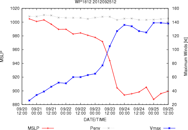
For comparison purposes, we will consider MSLP and maximum wind estimates from the multi platform tropical cyclone wind analysis:
Minimum Sea Level Pressure is calculated directly from the azimuthally averaged gradient level tangential winds produced by the multi platform tropical cyclone wind analysis. The circular domain for the numerical integration has a 600km radius. The pressure deficit resulting from the integration is then added to an environmental pressure. The environmental pressure (Penv) is interpolated from NCEP analyses in a circle 600 km from the cyclone center. The maximum surface winds produced by the analysis are also shown. For more detailed information see Knaff et al. 2011.
Experience has shown that this estimate of MSLP may be slightly too low with very intense tropical cyclones such as this, so that the minimum MSLP with this cyclone may be at (or slightly above) 900 mb. The MSLP values from this method are lower than the JTWC estimates. Since there is no aircraft recon data available, it is difficult to ascertain the actual MSLP and the winds are estimated via satellite methods with errors on the order of +/- 12 knots.
A loop of high resolution IR imagery of Jelawat can be pieced together from the various pass times of low-orbit polar satellites:
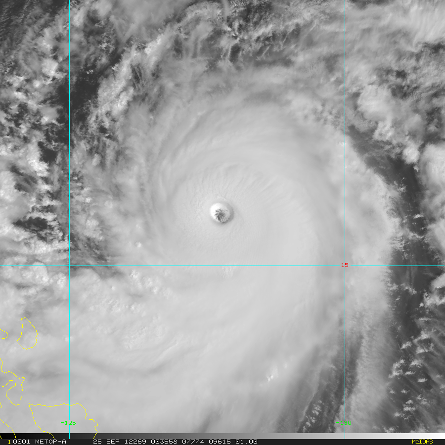
Here is the corresponding visible imagery at one of those times:
This imagery is available in real-time for global tropical cyclones at the CIRA Real-Time Tropical Cyclones Products web-page.
The Multiplatform Tropical Cyclone Surface Wind Analysis displays related real-time imagery.


