
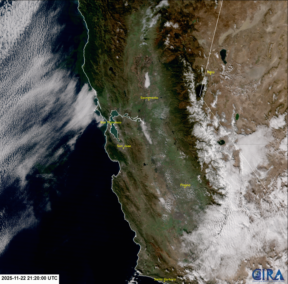
Tule Fog over the California Central Valley
Over the past three weeks, tule fog blanketed the California Central Valley, oscillating in size and extent across the region. The 400+ mile long, ~50+ mile wide valley, was inundated with fog that led to reduced ground visibilities for motorists and aviation, along with bringing cooler temperatures to the area. The VIIRS instrument from JPSS polar-orbiting satellites captured the fog and low stratus from late November to mid-December 2025. Daytime overpasses from the VIIRS GeoColor product, at 750-m spatial resolution, observed the fog embedded within the California Central Valley, that is situated between the Sierra Nevada Mountain Range (to the east) and the Coast Ranges (to the west).
VIIRS GeoColor from 22 November 2025 to 16 December 2025
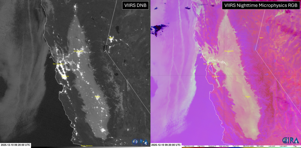
During the full moon phase of the lunar cycle, nighttime visible imagery from the VIIRS Day/Night Band (DNB, left) shows the extensive fog across the Central Valley and near the San Francisco Bay area. VIIRS DNB also depicts an array of emitted city lights across California, where at this timestamp, several cities were impacted by the fog. East of the valley, moonlight also reflects off the existing snow cover along the Sierra Nevadas. Corresponding VIIRS Nighttime Microphysics RGB imagery (right) identifies the fog in yellow-gray colors, indicating that the liquid water droplets were observed in cooler temperatures. Both products exhibit a 750-m spatial resolution.
VIIRS DNB & VIIRS Nighttime Microphysics RGB at 0920Z, 10 December 2025
Additionally, a video can be viewed here that captures motorists driving into the Tule Fog in December 2025.