Yuma County, CO – Wildfires
Last week, a few fires erupted within Yuma County, located in northeastern Colorado. The fire hotspots were first captured by geostationary satellites at ~0500 UTC, 18 December 2025, after cloud cover moved out of the region. GOES-19 5-minute infrared imagery shows the hotspots in white and red pixels at 2-km spatial resolution. At ~0630 UTC, a strong cold front moves in from the north, bringing high, gusty winds that amplified the fire spread toward the south. As of 19 December 2025, the fires burned approximately 14,000 acres.
GOES-19 ABI 3.9 um from 3-12Z, 18 December 2025
Surface observations depict the strong, west-northwest winds (with 50+ mph wind gusts) moving quickly through northeastern Colorado and western Kansas, as the cold front lowered air temperatures into the low 30’s overnight.
Surface Observations from ~3-12Z, 18 December 2025
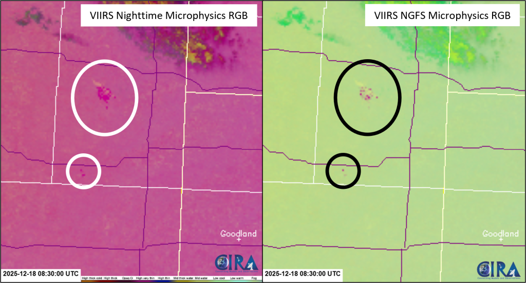
During the overnight hours, SNPP VIIRS observed two of the fires located in the southern portion of Yuma County. The VIIRS Nighttime Microphysics RGB, primarily used for fog and low cloud detection, can also be used for fire monitoring at night, as the green spectra of this RGB utilizes a brightness temperature difference that includes the 3.7 um. Within this RGB, the fire pixels are shown in dark pink pixels. Additionally, the new VIIRS NGFS Microphysics RGB, utilizes a combination of longwave and shortwave infrared channels to observe fires during the day or night. The NGFS Microphysics RGB depicts fires in pink pixels during the nighttime. Both RGBs have a 750-m spatial resolution.
JPSS VIIRS Nighttime Microphysics RGB and NGFS Microphysics RGB at 0830Z, 18 December 2025