Typhoon Hagupit
By Kate Musgrave
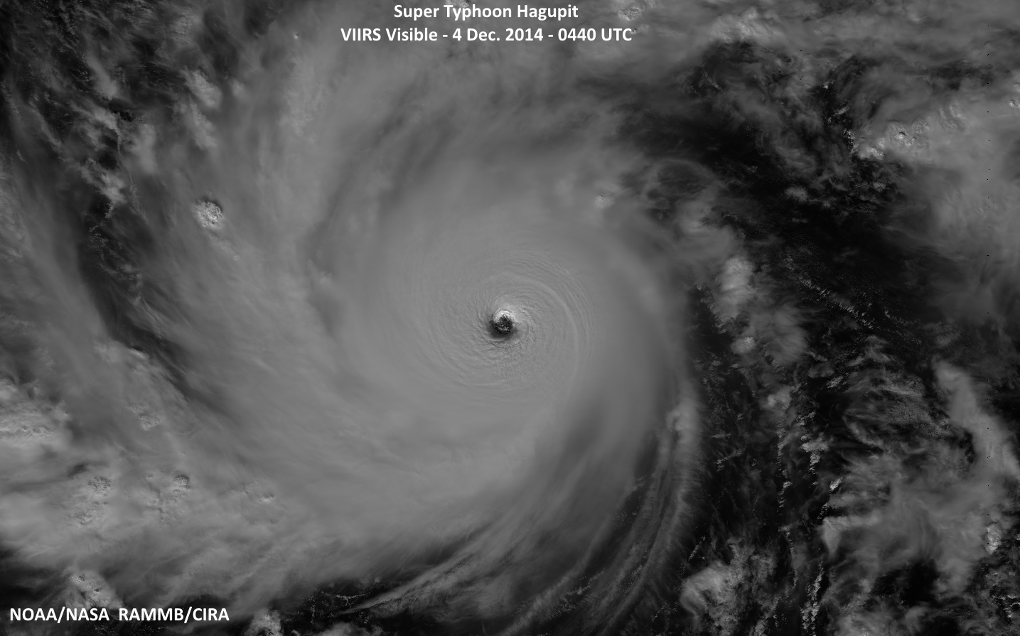
Typhoon Hagupit in the northern West Pacific basin underwent intensification until reaching a peak intensity of 155 kt at 0000 UTC on 4 Dec 2014 (intensities obtained from Joint Typhoon Warning Center (JTWC)). This was a 65 kt increase over the intensity 24 hours previous (90 kt at 0000 UTC on 3 Dec 2014) and marked Typhoon Hagupit as a supertyphoon. VIIRS overpasses were available both during the intensification and at peak intensity in Typhoon Hagupit (all images provided by Dan Lindsey, NOAA/NESDIS). Below is shown the VIIRS visible image from Typhoon Hagupit at 0440 UTC on 4 Dec 2014, at peak intensity.
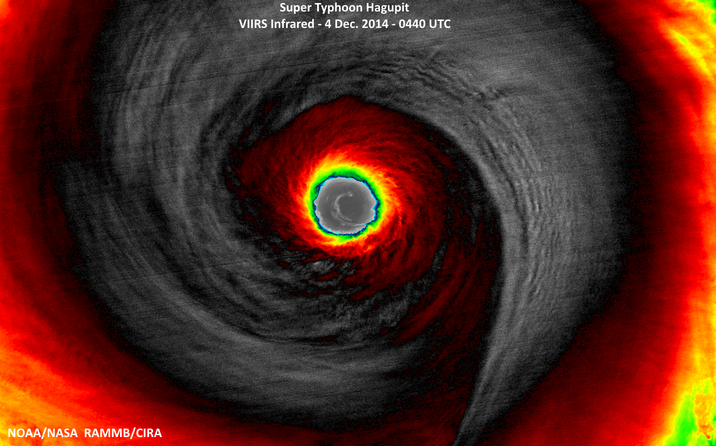
Zooming in further, displayed below is the infrared from the same VIIRS overpass. The eye is clear down to the ocean surface and both the eye and eyewall display highly symmetric features.
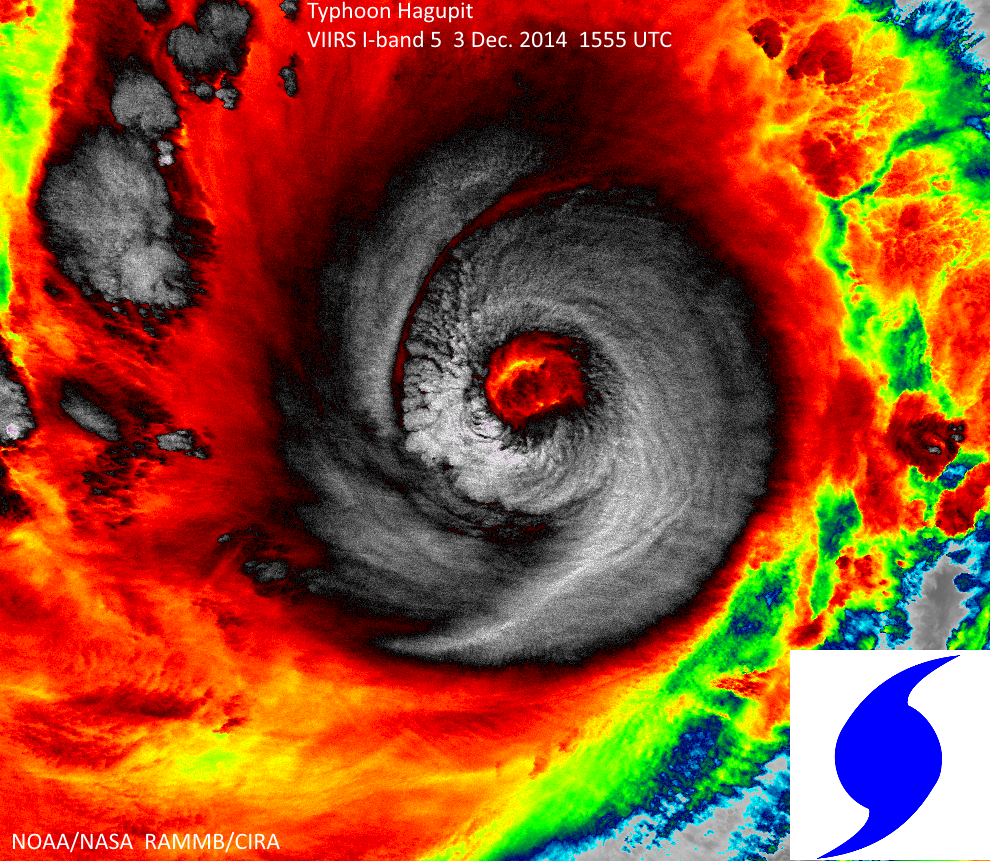
Previously, a VIIRS overpass occurred at 1555 UTC on 3 Dec, during the period when Typhoon Hagupit was rapidly intensifying (the intensity at 1200 UTC on 3 Dec was 100 kt). Shown below is the infrared from that earlier VIIRS overpass:
Notably, the features in the eye and eyewall at this time are more asymmetric, with the interface between the eye and eyewall appearing more ragged and less circular than at peak intensity. The eye has also not yet cleared out to the ocean surface. The overall shape of the coldest cloud tops at this time bears a particularly strong resemblance to the common symbol used for representing tropical cyclones, as illustrated in the bottom right corner of the figure.


