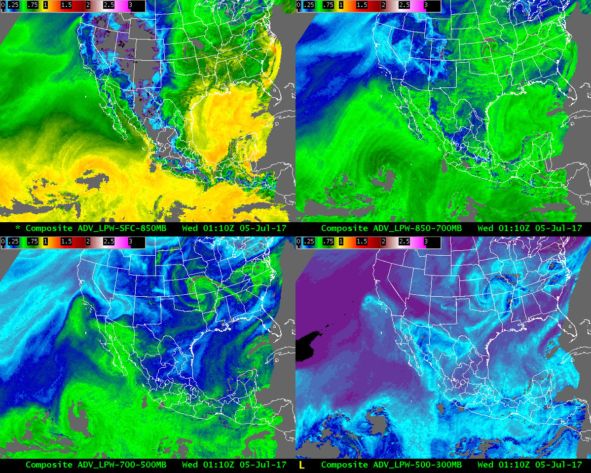
Onset of southwest monsoon as depicted by the CIRA advected LPW product
Between the first and second week of July, moisture associated with the southwest monsoon surged into the Mojave dessert. Prior to the arrival of this airmass, very hot temperatures and low dewpoint temperatures existed throughout the southwest. After the arrival of this airmass, temperatures were not quite as high, and dewpoint temperatures were considerably higher. The CIRA advected layer precipitable water product at 01Z on 5 July 2017 was representative of before the arrival of this moist airmass across the southwest:
For example, in the 850-700 mb layer (upper right panel) the blue colors represent a much drier airmass in southern California and Arizona, with a moist airmass just south of the Mexico border (in the green shades).
Soon afterwards, we see in this animation the advection of moisture from Mexico into the southwest US:
this more moist airmass at mid/upper levels goes around the strong 500 mb ridge to bring mid/upper level moisture into much of the intermountain west. The greater moisture introduces better chances for rain, particularly for regions that had been very hot and dry.

