
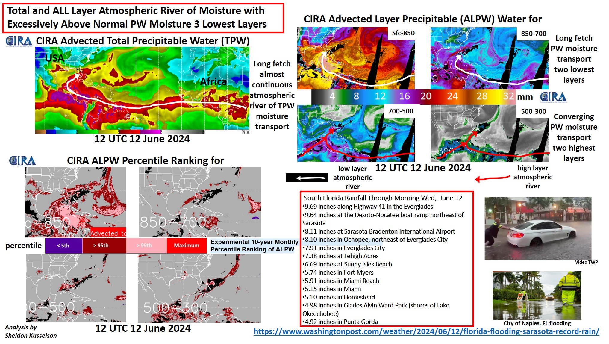
12 June 2024 Florida heavy rainfall event
June 12th, 2024 by Dan BikosBy Sheldon Kusselson
Posted in: Heavy Rain and Flooding Issues, Hydrology, | Comments closed
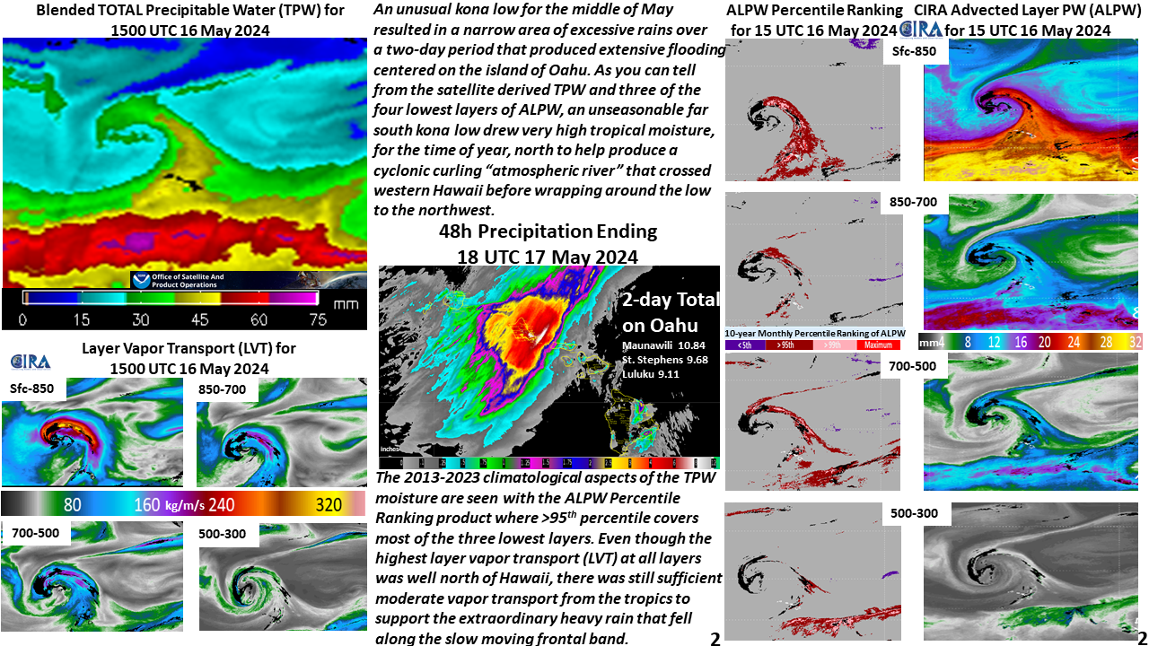
Drenching Rains 16-17 May 2024 From Most Impactful Kona Low in 20 Years Resulted in Flooding Across Western Hawaii
May 23rd, 2024 by Dan Bikos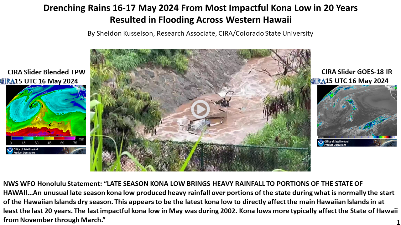
Posted in: Heavy Rain and Flooding Issues, POES, | Comments closed
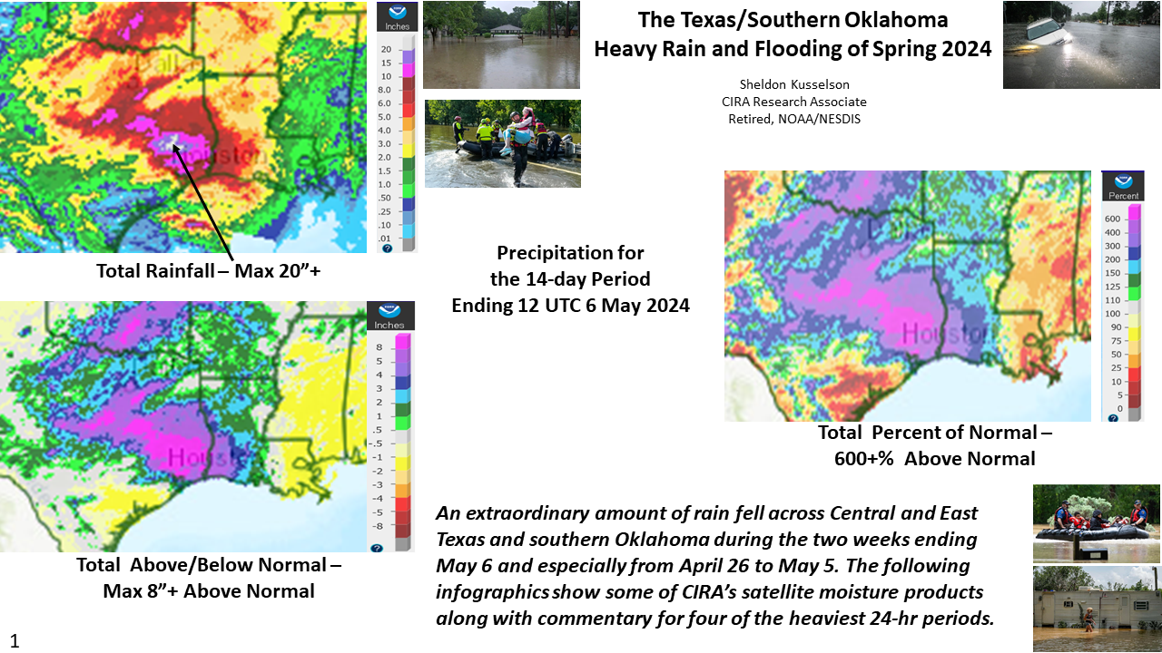
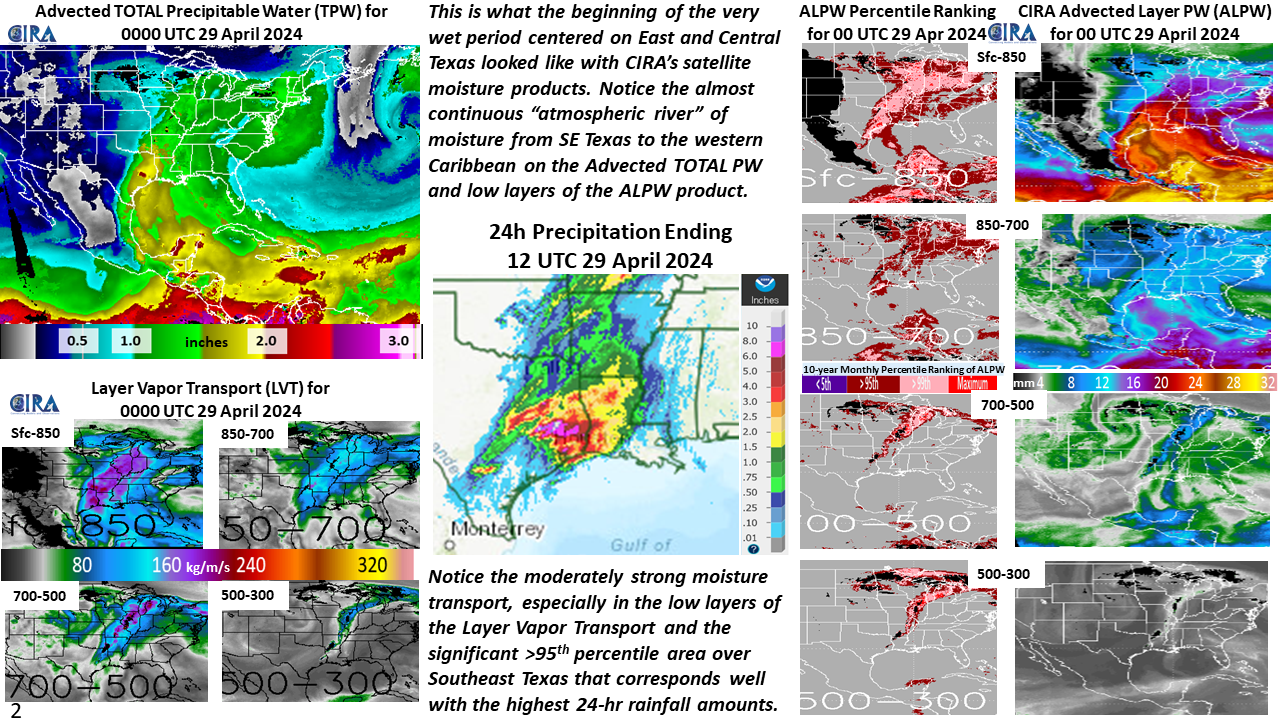
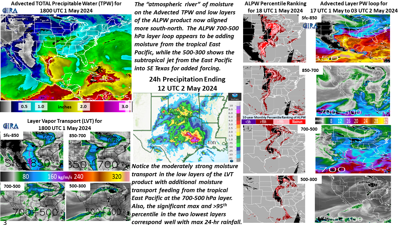
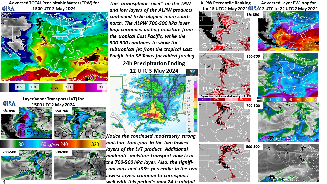
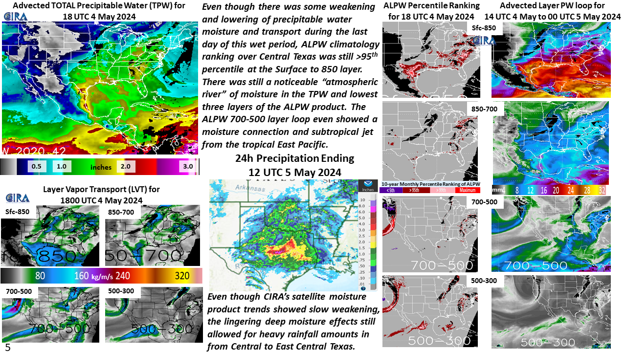
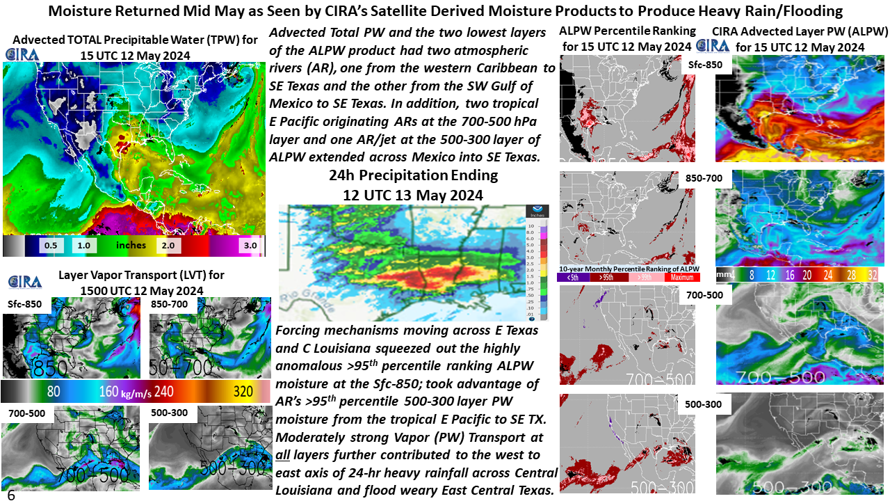
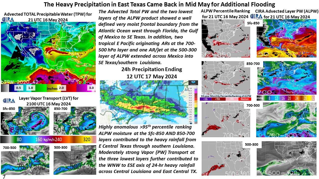
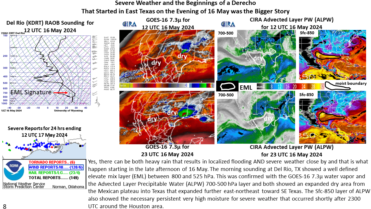
The Texas / Southern Oklahoma Heavy Rain and Flooding of Spring 2024
May 21st, 2024 by Dan BikosBy Sheldon Kusselson
Posted in: Heavy Rain and Flooding Issues, POES, | Comments closed
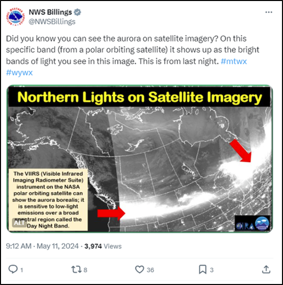
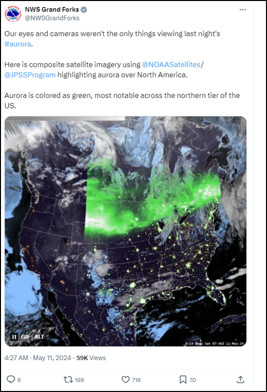
The Northern Lights Observed in the Lower-48
May 14th, 2024 by Jorel TorresA powerful geomagnetic storm transpired over the Lower-48 during the weekend of 11-13 May 2024. The sun produced coronal mass injections that impacted the Earth, creating auroras (a.k.a., northern lights) that were seen across the globe. Within CONUS, the auroras were visible as far south as Florida, Texas, and Alabama: locations where the northern lights are typically not observed. Spectacular photos of the event can be seen here.
Accessing the CIRA SLIDER – JPSS Northern Hemisphere Sector, one can observe the northern lights that dominated the northern tier of the U.S. from 6-12Z, 11 May 2024. The VIIRS Near-Constant Contrast (NCC), a derived product of the Day/Night Band (DNB) captures the extensive, emitted white streaks that are produced from the auroras. Clusters of emitted city lights can also be seen across CONUS.
National Weather Service (NWS) Weather Forecast Offices (WFOs) employed social media to highlight the nighttime visible imagery as a way to observe the northern lights. Click on the images below to view the social media posts and animations.
Posted in: POES, Satellites, Space Weather, VIIRS, | Comments closed
CIRA’s Satellite Moisture Products for the 4 May 2024 Rainfall Event in San Francisco
May 7th, 2024 by Dan Bikos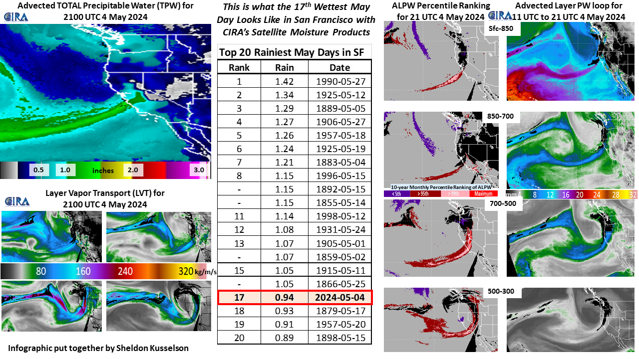
Posted in: Miscellaneous, | Comments closed