An Atmospheric River impacts the PNW
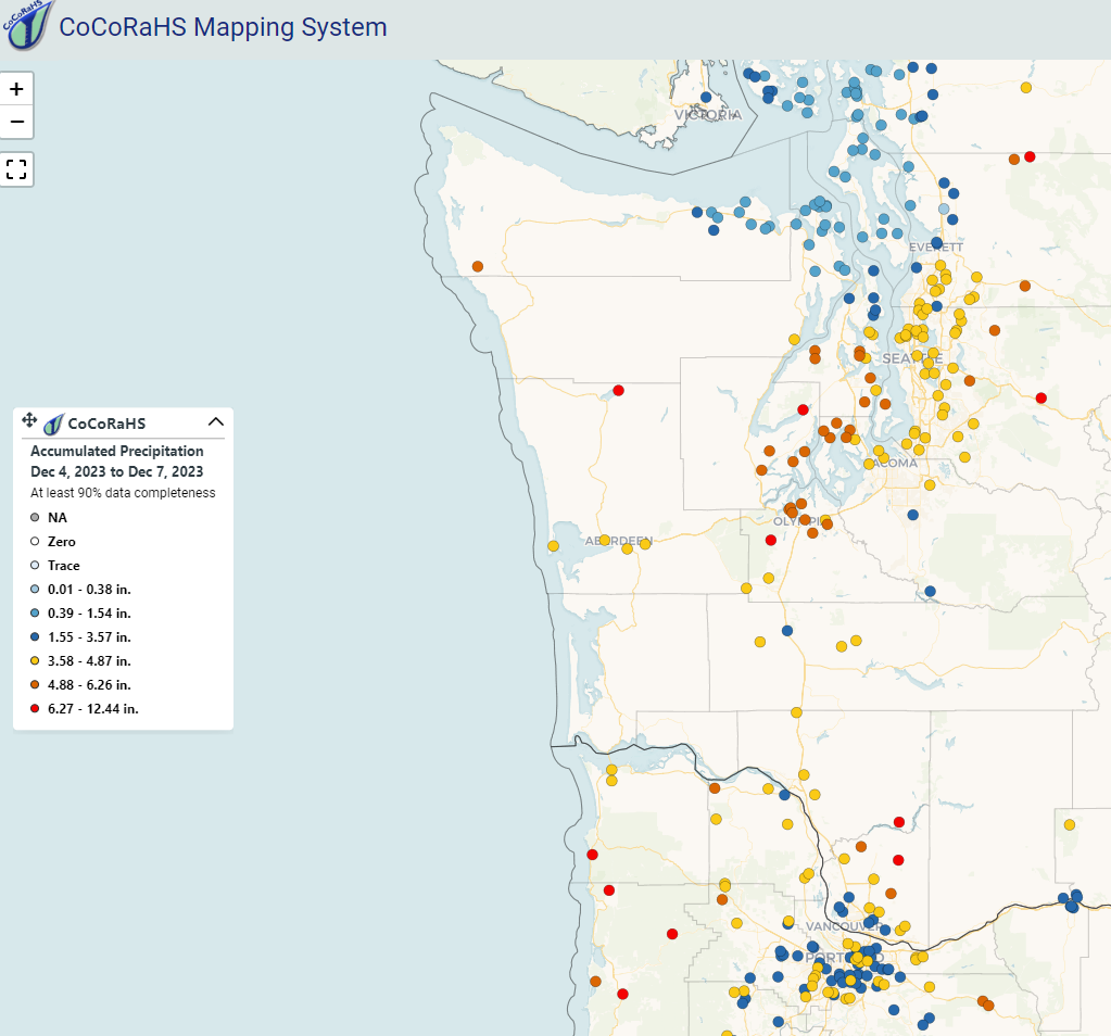
Another atmospheric river event impacted the Pacific Northwest (PNW), earlier this week. Plumes of moisture moved into the region that led to heavy precipitation and flooding for the states of Washington, Oregon, and Idaho. 24-hour precipitation totals from Monday, 4 December through Tuesday, 5 December 2023 were quite impressive over western Washington. Additionally, the Seattle-Tacoma (Sea-Tac) and Olympia Airports broke their respective precipitation records for daily rainfall. Accumulated precipitation totals (via CoCoRaHS) from 4-7 December 2023 are seen below over western Washington and northwestern Oregon.

Polar orbiting satellites observed the atmospheric river, located along the southeast side of a low pressure system that made landfall in southeast Alaska. The AWIPS 4-panel below highlights three products: the Blended Total Precipitable Water (TPW), the Blended Percent of Normal TPW, and the Blended Rain Rate. The Blended TPW product shows the total TPW throughout the atmosphere and observes the elongated moisture plume that spans from the tropics northeastward into the PNW. The Percent of Normal TPW is based on the 1988-1999 NASA NVAP climatology and can be employed to observed the significance of the atmospheric moisture in the region. Near-climatological normal TPW values (white colors) and above normal climatological values (aqua and yellow) are observed within the atmospheric river throughout the time period. Observing rain rates over data-sparse regions (e.g., oceans) is key to the utility of the Blended Rain Rate product, where an extensive line of heavy precipitation advects toward and over the PNW.
Blended TPW (top-left), Blended Percent of Normal TPW (top-right), and the Blended Rain Rate (bottom-left) observations from 2Z, 4 December 2023 to 16Z, 5 December 2023.
The Advected Layer Precipitable Water (ALPW) product also observed the atmospheric river. ALPW is a unique product, in which it observes precipitable water values in 4 atmospheric layers: surface to 850 mb, 850 mb to 700 mb, 700 mb to 500 mb, and 500 mb to 300 mb. An ALPW animation (see below) highlights the evolution of the atmospheric river over the course of 3 days; notice high precipitable water values not only in the low levels of the atmosphere, but also in the upper-levels (i.e., 700-500 mb layer). Note, the ALPW units are expressed in inches.
ALPW observations from 20Z, 4 December 2023 to 15Z, 6 December 2023.
Want to access the blended products and the ALPW online?
Users can access the data via the following weblinks: Blended Rain Rate, Blended TPW, Percent of Normal TPW, and ALPW. Additional product links can be accessed via the JPSS Imagery for Users webpage.
