
GK2A Extended Local Area now on SLIDER
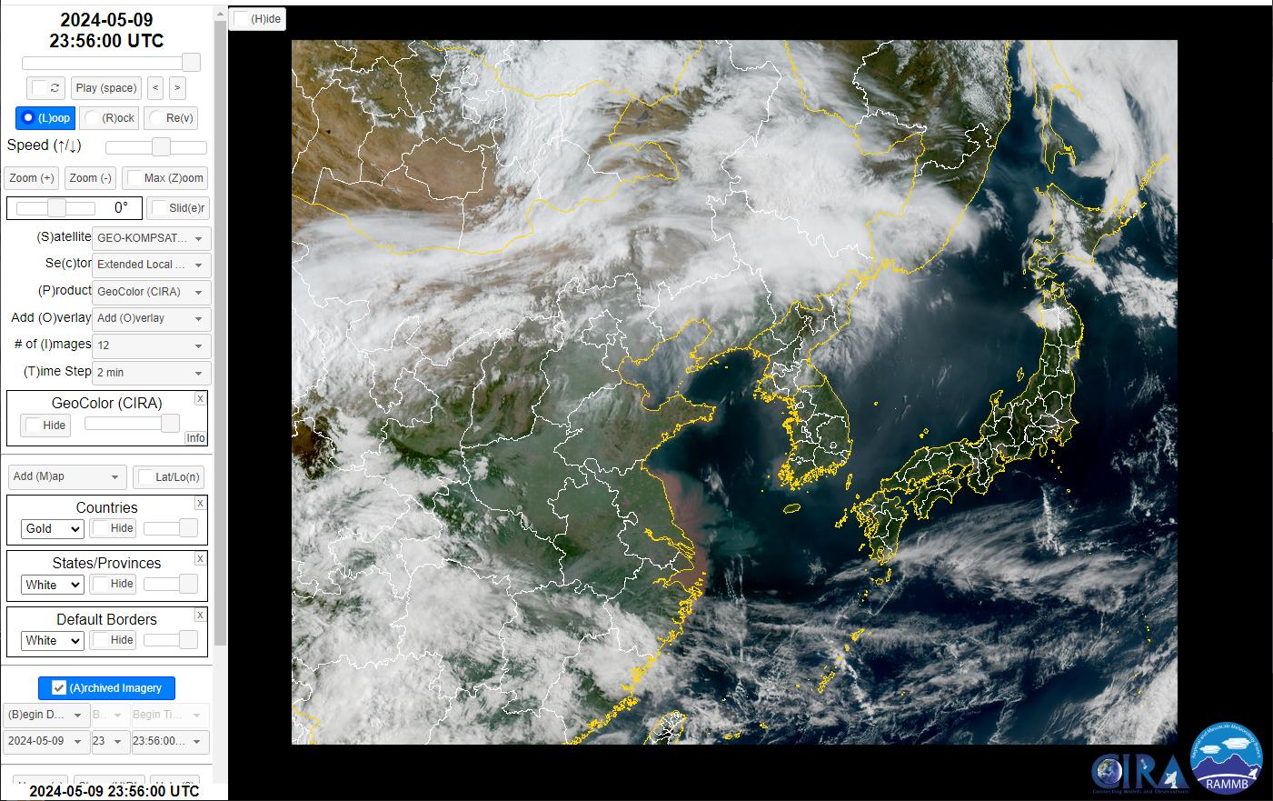
Since 2023, CIRA has been providing imagery from the Advanced Meteorological Imager (AMI) onboard GeoKOMPSAT-2A thanks to a data sharing agreement with the Korea Meteorological Administration (KMA). Initially, the data offered to CIRA included Full Disk and Local Area sector imagery. As with GOES-16/18 ABI, Full Disk imagery is provided every 10 min. The Local Area is a 1000 x 1000 km box typically centered over Korea, providing 2 min. imagery. In a show of appreciation for CIRA’s efforts to add AMI imagery to SLIDER, KMA is now offering data from the Extended Local Area (ELA) sector to CIRA. This is an approximately CONUS-sized sector centered on Korea that also provides 2 min. temporal refresh. Unlike the ABI CONUS/PACUS sectors, however, the data is remapped to a Lambert Conic Conformal projection prior to delivery. An example of this sector is provided in the figure below. The ELA sector is now publicly available on SLIDER (https://rammb-slider.cira.colostate.edu) – simply select “GeoKOMPSAT-2A” from the Satellite menu and “Extended Local Area” from the Sector menu. (POC: C. Seaman, Y.J. Noh, Z. Amundson, K. Micke, A. Tomar and N. Tourville, CIRA; curtis.seaman@colostate.edu; yoo-jeong.noh@colostate.edu; zayd.amundson@colostate.edu; kevin.micke@rams.colostate.edu; aniket.tomar@colostate.edu; natalie.tourville@colostate.edu) Funding: GOES-R
Download Weekly Report (PDF)
Posted on: May 31, 2024
Page Contact
Unless otherwise noted, all content on the CIRA RAMMB: VISIT, SHyMet and VLab webpages are released under a Creative Commons Attribution 3.0 License.