
New Satellite Liaison Blog Post
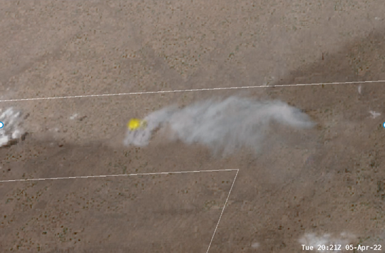
Bill Line published a blog post titled “GOES-East Captures Frontal Passage”. The post discusses how NWS Amarillo, TX leveraged 1-min GOES satellite imagery to track the progression of a cold front and related wind shift in relation to local wildfires. This information was communicated to the public via social media, and to local partners via Decision Support Service (DSS) phone briefings. A local emergency management office confirmed that they moved personnel based on the NWS briefings of the frontal passage timing, which they got directly from watching the satellite imagery. See Figure below. The link to the post can be found here. (POC: B. Line, CoRP/RAMMB, bill.line@noaa.gov) Funding: PDRA
Download Weekly Report (PDF)Posted on: April 8, 2022
Page Contact
Unless otherwise noted, all content on the CIRA RAMMB: VISIT, SHyMet and VLab webpages are released under a Creative Commons Attribution 3.0 License.