
Clouds
The Basics
While all clouds are made out of water in different physical states – liquid droplets, vapor, or ice crystals – the way those water particles arrange themselves can vary greatly. Many factors influence that arrangement: temperature, altitude, presence of other particles, winds… because of that, we can use information about cloud shapes to create models to get information about the weather – which some meteorologists actually do to help you pick your outfit in the morning. While looking into satellite images over time helps professionals to predict the weather, any person can obtain good information just by looking at the sky with a naked eye. The topics below will hopefully help you to get familiar with some of the basics of clouds watching.
Basic Shapes of Clouds
The four basic types of clouds are strato, cirro, cumulo, and nimbo – all Latin terms that will help you remember the clouds’ forms, once those generally describe a specific shape.
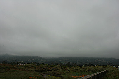
- Strato: The clouds with strato in their name will be spread, like a layer of something you spread over your toast – that’s what strato means in Latin, by the way: “layer”. They will normally be seen along warm fronts – that is, the layer of air that precedes the warm air right before it hits the cold air in the atmosphere. This temperature difference is what causes the water particle to spread.
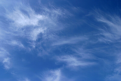
- Cirro: Cirro means “curl of hair”, and these clouds gained this name because they are thin and they may not be a layer like the strato type – hence, they are “like a curl of hair”. Hurricanes and storms are very likely to be preceded by a cirro formation due to the low pressure of those phenomena; that is, low pressure means the water particles will be more spread, so they won’t look dense or “fluffy” when we look at them from the ground. “Cirro” clouds are the highest in the sky, so many times they are composed of ice crystals.
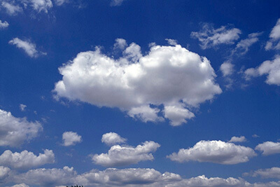
- Cumulo: Those are the clouds we are so used to draw since we were little kids; They are denser in shape and normally have well-defined lines, giving them the appearance of fluffy cotton balls or cotton candy. An uplift of air is what makes them look fluffy, as the water particles seem to be closer together when the water vapor becomes liquid. Another easy way to spot a cumulo: they will have flat-bottom lines, almost like they are on an invisible flat surface.
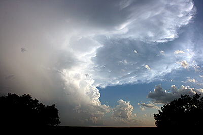
- Nimbo: Literally meaning “rain”, nimbo clouds are those that normally bring rain or snow storms. They will actually be a combination with strato, cirro, and/or cumulo clouds – such as cumulonimbus and nimbostratus – and they vertically occupy a large part of the atmosphere – a.k.a., they are very “tall”. Think about it like this: a lot of water particles need to be accumulated in the atmosphere to then become rain… that’s why nimbo clouds are very high in altitude and are easy to spot. Because they are so dense and tall, less sunlight is able to pass through them, and that’s what makes rain clouds have a darker color. The darker the color of a cloud, the denser, or more “grouped together” water particles are. Light is also composed of particles, so those particles coming from the Sun have a harder time to cross our atmosphere; hence, dark gray, scary-looking clouds
Classification of Clouds
It is very common to combine those four core types to describe more complex cloud formations. If you want to explore those types, check the chart provided by the National Weather Service, and if you want to become a cloud observer, don’t forget to check all the cloud resources The Bolt grouped for you.

Click on the image above to open the classification chart by the NWS; when the chart opens, click over the individual cloud pictures to learn more about each one of the different formations
Height of Clouds
While we normally hear the weather forecast speaking of the low, medium, and high clouds, where you are on the planet is also important to make that classification. Before we tell you about cloud heights, let’s talk about tropical, temperate, and polar regions. Those regions influence determine where the tropopause occurs – that is, the boundary between the troposphere and the stratosphere, or “the limit” where cloud formation stops. The state of Colorado and the continental US are nearly always within the temperate zone, as you can see in the picture below.

Now, let’s take a look at the second picture, created by the National Weather Service; as you can see, in the temperate zone we have low clouds up to 6,500 ft – which is the same for all regions. However, the medium clouds are found between 6,500 ft and 16,500 ft, a mixed zone between 16,500 ft and 23,000 ft – where we won’t normally see smaller cloud formations. For last, we see that high clouds can go all the way to 45,000 ft in the temperate zone – much different from the tropical and polar regions.

For perspective, the tallest building in the world – the Burj Khalifa, in Dubai – is 2,717 ft, well below the medium-height clouds, so those impressive pictures of buildings going “over the cloud line” show only low-clouds. But you can still be as high as the highest clouds: most commercial airplanes will fly up to 45,000 ft – that is, even above most of the highest clouds! That’s why, from an airplane window, you may see a completely clear sky at one point of your trip. Mount Albert, the tallest summit of the Colorado Rocky Mountains, is almost as tall as the highest clouds.
The Burj Khalifa amongst clouds; in Dubai, the building is the tallest one on Earth
Rare and Special Clouds
Some cloud formations are very distinct in their shape, and sometimes are even hard to be seen. The list below brings some of those formations and why they look the way they do.
- Mammatus: from the Latin “mamma”, or breast, this peculiar formation was named for the resemblance to female breasts. You will normally find Mammatus clouds after strong storms. This happens because pockets of air will warm up and descend to the bottom of a cloud.
Mammatus clouds after intense storms in Texas. Credit: Matt Roberts
- Arcus: Another interesting formation that normally follows extreme weather, arcus clouds are low, big cells formed by strong and unstable winds. They can be of two types: roll or shelf. Roll is a rare formation that’s detached from the storm cloud – which is normally a cumulonimbus – while a shelf will be attached to the bottom of the cumulonimbus and may present a very defined edge, called a front gust.
Shelf cloud with a defined front gust formed during thunderstorms in the Netherlands. Credit: John Kerstholt
A rare formation, this roll cloud was photographed over the coast of Uruguay. Credit: Daniela Mirner Eberl
- Lenticularis: Very common close to mountains and peaks, this formation occurs when wind finds a barrier on its path, but then returns to the original level, leaving clouds looking a bit like a contact lens – just remember that “lenticular” means “lens-shaped”. Depending on the winds and obstacles, these formations are also almond-shaped.
Lenticularis cloud formation. Credit: UCAR
- Kelvin-Helmholtz: Don’t those look like ocean waves breaking? This very interesting pattern is formed due to parallel wind currents that are moving at different speeds and/or different directions. Lucky Coloradans may see this formation over the Rockies, as the mountains are a possible barrier that blocks currents of air, giving the wind different speeds. They don’t normally last very long as the currents quickly start to stabilize. The complicated name is due to two scientists, Lord Kelvin and Hermann von Helmholtz, who formulated a theory to describe the instability in fluids – remember that clouds considered a fluid – fluids are not just liquids, but gases as well.
Kelvin-Helmholtz clouds over the Rocky Mountains. Credit: UCAR
- Noctilucent: We had to present to you this oddball that you may never hear about. Found at over 85,000 ft, these formations are not a weather phenomenon. Instead, they are accumulations of ice crystals very high in Earth’s mesosphere – the portion of space between the stratosphere and the thermosphere, this last one is where we find all the other type of clouds. Because these require extremely cold weather, they are normally seen closer to Earth’s poles. Fun fact: if observed from space, this same cloud will be called Polar Mesospheric Cloud, so, you may have guessed: a satellite will never observe noctilucent cloud, but a polar mesospheric one!
Noctilucent cloud over the north of Estonia. Credits: Ireen Trummer
From Above vs. From Below
Now that you learned a lot about clouds shapes and heights, it would be natural if you started asking yourself how such a variety of clouds might show up in satellite imagery. Do you think they look different depending on how high they are? What about the shapes: if a cirrus cloud looks very different from a nimbus from the ground, will satellites show those important differences?
The answer, sadly, is more complicated than a yes or no! This is because satellite imagery can give you information on clouds’ shape and height, but those are much trickier to catch. While some differences might be easy to see – such cloud formations around big hurricanes – smaller shapes are much harder to distinct for an untrained eye.

A GOES-R satellite image of Hurricane Katrina over the Gulf of Mexico. Credit: GOES-R/NASA
Think about it like this: visualize a big, green forest you have seen in the past. Can you tell the different types of leaves or even the different trees apart from far away? Probably not. But what if you walk all the way to that tree? You may not be able to tell the tree’s species, but you probably can tell the shape of a eucalyptus tree from an aspen one. That’s a little bit like the satellite imagery. An experienced botanist, who is very familiar with all sorts of trees, most likely can tell the difference between those trees even from far away, sometimes using context information, like geography or altitude, once those trees may not grow under the same conditions. In the same way, a meteorologist who may work daily with satellite imagery can use contextual information, such as region and winds, to identify clouds even from above.
Resources on Clouds: Training and Apps
Whether you are a quick, fun-facts lover or getting some cloud-related schoolwork done, or even trying to understand deeper everything about clouds, use the resources below to complement your learning process!
Training
The list below is for those who want to have a deeper understanding of clouds! The links will take you to credible sources related to the National Oceanic and Atmospheric Administration (NOAA) – a federal organization that is also one of the partners of CIRA.
SciJinks: Want to learn about cloud topics in a more informal way? This is your place! Similarly to The Bolt, SciJinks has hundreds of articles, videos, and experiments to help you learn about clouds in an immersive way.
Clouds from The National Weather Service (NWS): A very structured, directed way to deepen your knowledge on clouds. The articles are sequential, so you never move to a new topic without understanding the previous one!
Smartphone Apps
Just type the name as written below in your app store and look for the matching logo.

GLOBE Observer: Connected to a citizen scientist program, this app offers a chance to interact with the GOES-R satellite and compare your own sky observations with the satellite images. For example, you can add a detailed live entry from your location, and within 48 hours you will get an email telling you how correct you were, and satellite images of your exact location. A great way to practice your weather observations and be part of a real scientific program! Free, available to iOS and Android.

Cloud-a-Day: Don’t want to be part of a bigger project yet? No problem! This app is for the occasional cloud spotter. For each cloud type, you can read very detailed information like height and precipitation probability, and also compare to other cloud types. After registration, you can start creating your own gallery of cloud pictures. Free, available to iOS and Android.

Field Guide to Clouds: Simple and lighter app to help you identify the clouds you observe from the ground, what kind of weather they may bring, and tons of fun facts about clouds. Free, available to iOS and Android.
Page Contact
Unless otherwise noted, all content on the CIRA RAMMB: VISIT, SHyMet and VLab webpages are released under a Creative Commons Attribution 3.0 License.