
Tropical Cyclone Wind Speed Probabilities – Case Studies
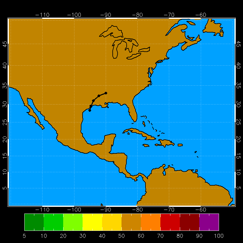
Hurricane Isabel Example 18 UTC 09 Sep 2003
Animation of the tracks of the 1000 realizations at 12 hour intervals (upper), and the total tracks for the full length of the NHC forecast (lower). The NHC forecast track is also shown with a black outline.
The 0-120h cumulation proabilities of 34 (upper), 50 (middle), and 64kt (lower) winds.
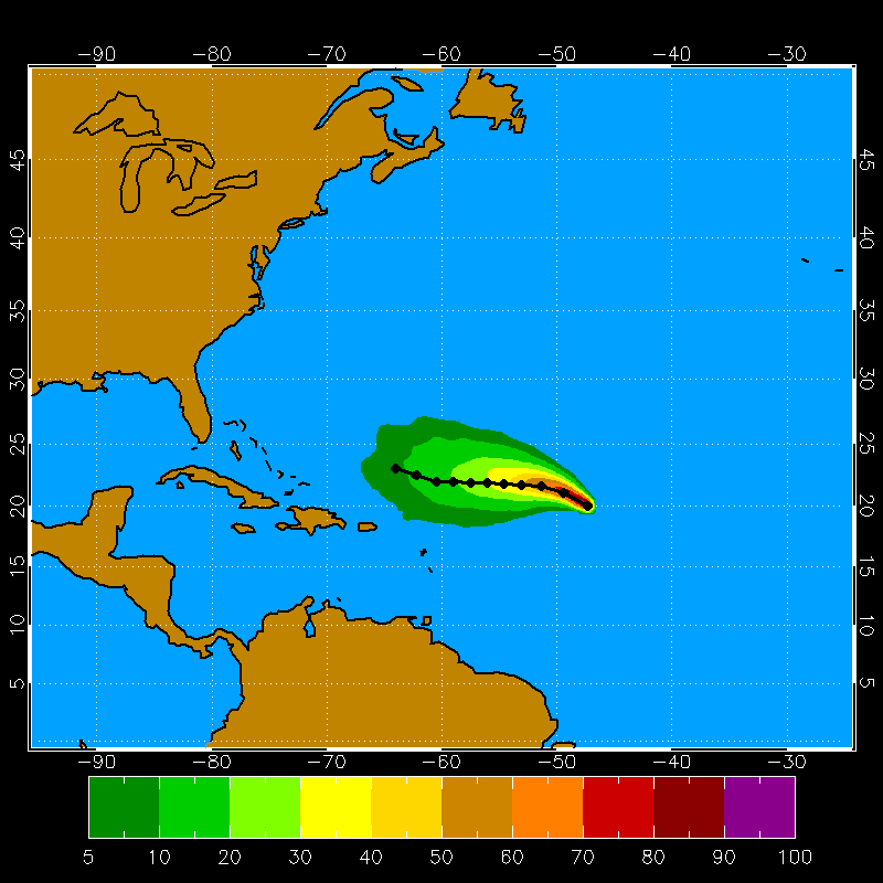
Tropical Storm Katrina Example 18 UTC 24 Aug 2005

Animation of the tracks of the 1000 realizations at 12 hour intervals (upper), and the total tracks for the full length of the NHC forecast (lower). The NHC forecast track is also shown with a black outline.
The 0-120h cumulation proabilities of 34 (upper), 50 (middle), and 64kt (lower) winds.
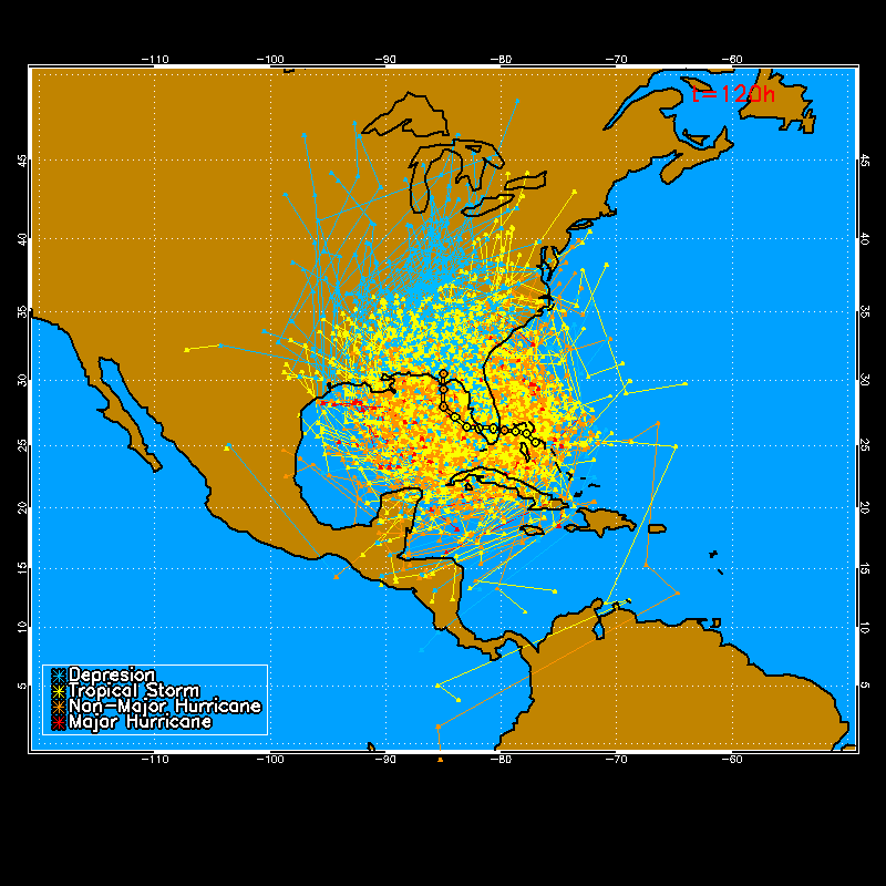
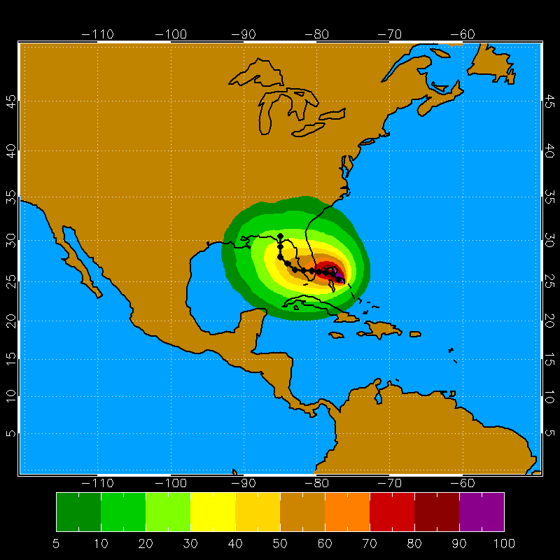
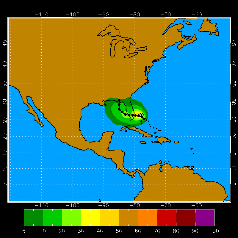
Hurricane Katrina Example 18 UTC 26 Aug 2005

Animation of the tracks of the 1000 realizations at 12 hour intervals (upper), and the total tracks for the full length of the NHC forecast (lower). The NHC forecast track is also shown with a black outline.
The 0-120h cumulation proabilities of 34 (upper), 50 (middle), and 64kt (lower) winds.
Tropical Storm Ernesto Example 18 UTC 28 Aug 2006

Animation of the tracks of the 1000 realizations at 12 hour intervals (upper), and the total tracks for the full length of the NHC forecast (lower). The NHC forecast track is also shown with a black outline.
The 0-120h cumulation proabilities of 34 (upper), 50 (middle), and 64kt (lower) winds.
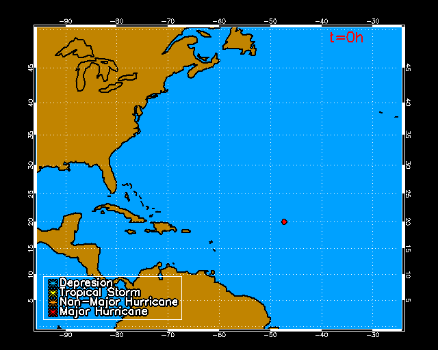
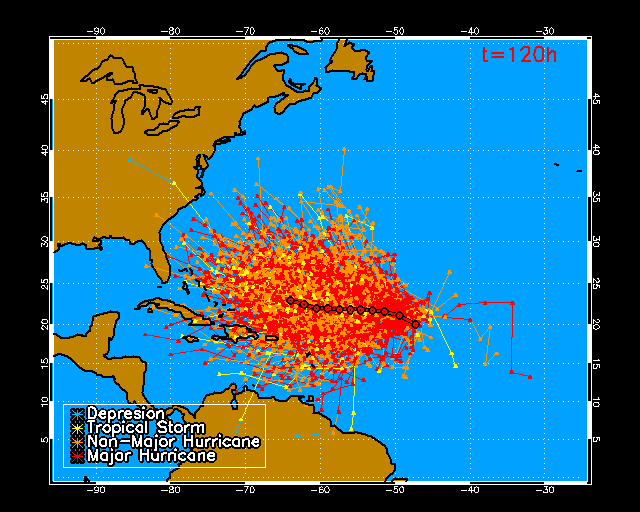
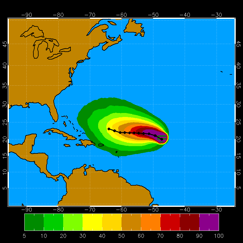
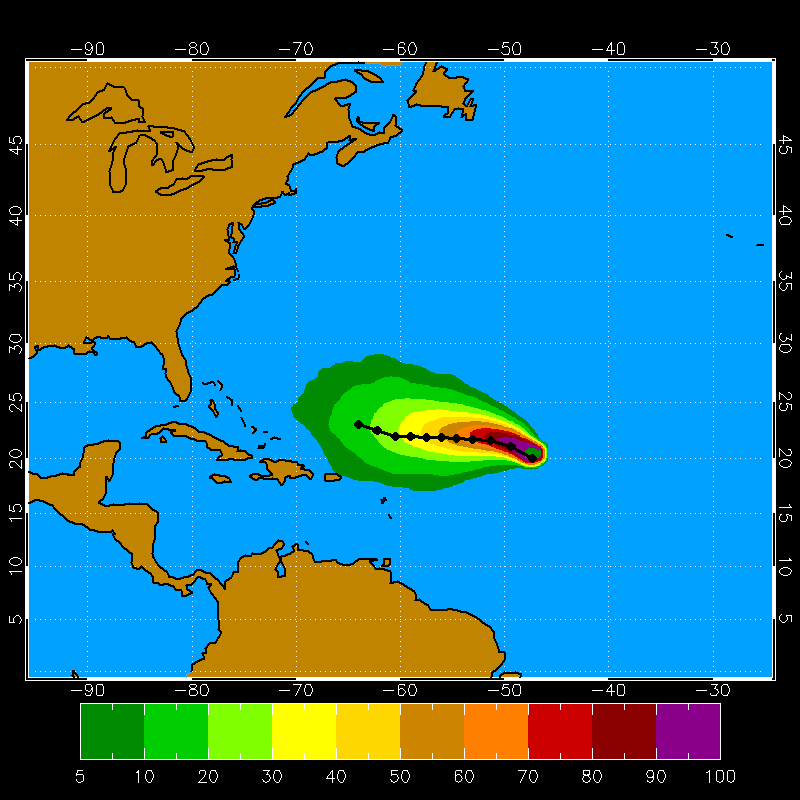
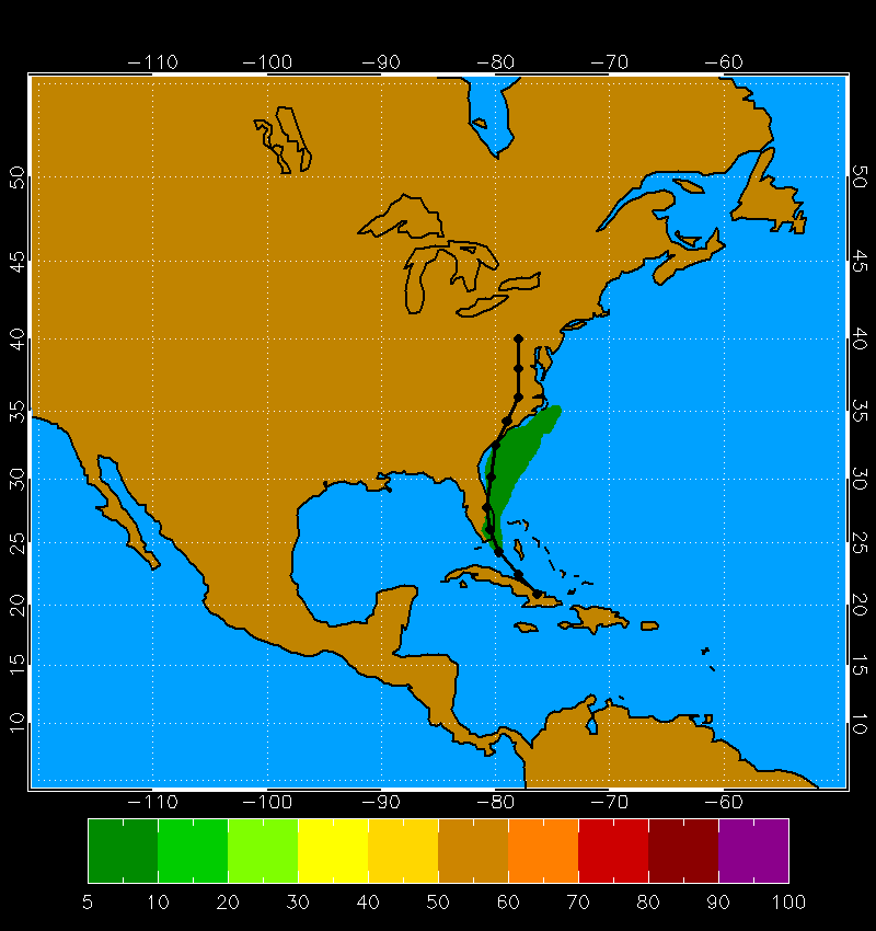
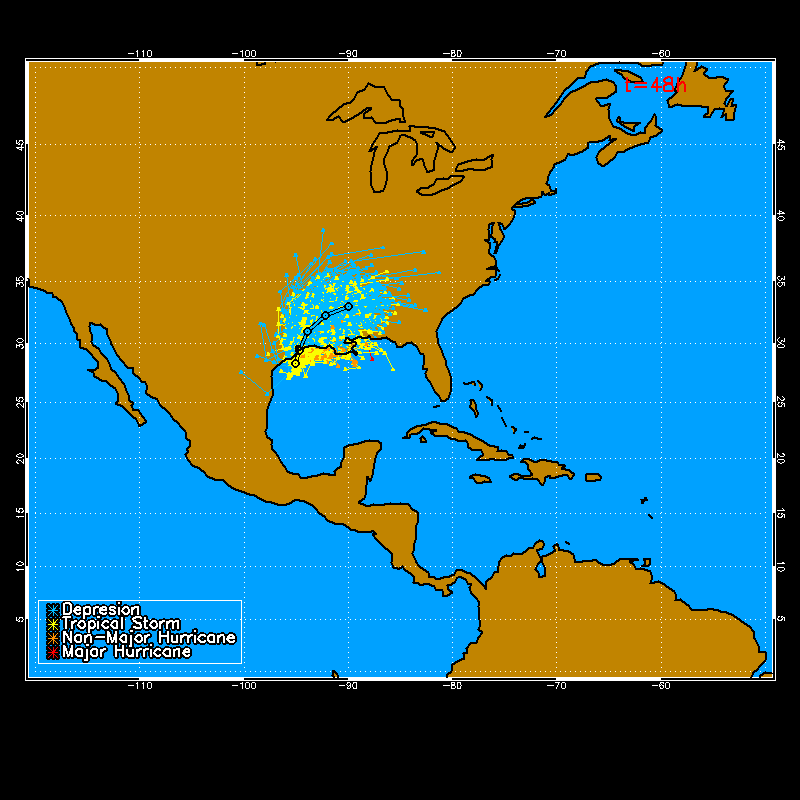
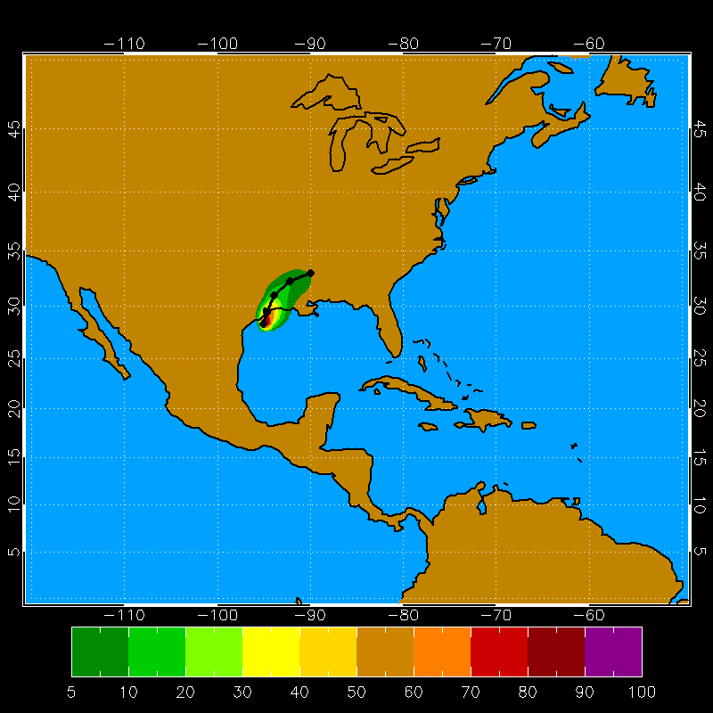
Hurricane Dean Example 18 UTC 17 Aug 2007
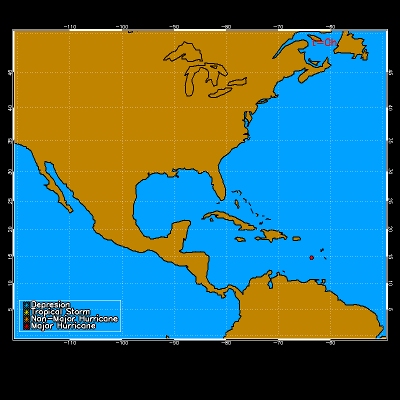
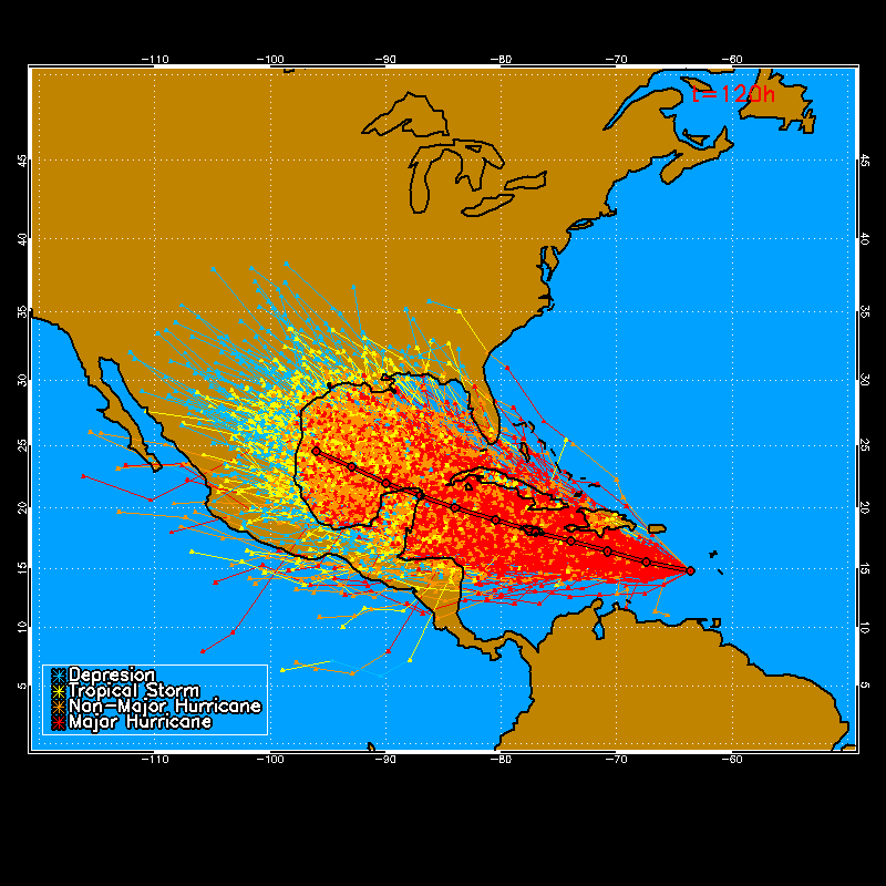
Animation of the tracks of the 1000 realizations at 12 hour intervals (upper), and the total tracks for the full length of the NHC forecast (lower). The NHC forecast track is also shown with a black outline.
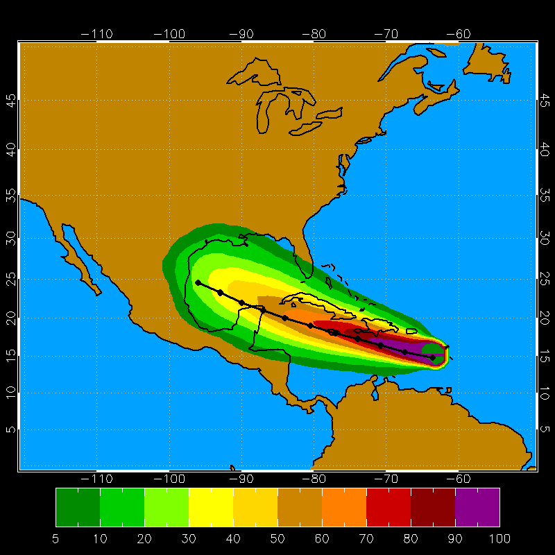
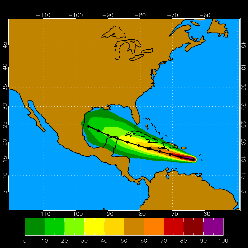
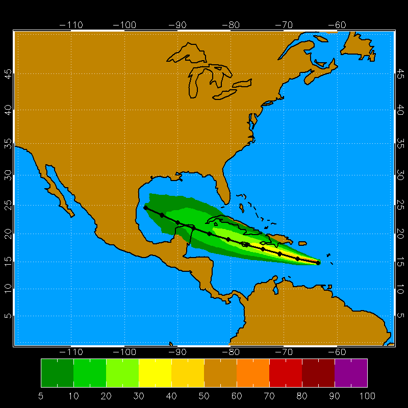
The 0-120h cumulation proabilities of 34 (upper), 50 (middle), and 64kt (lower) winds.
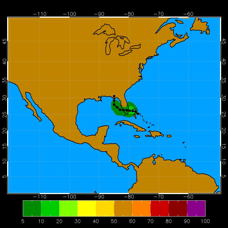
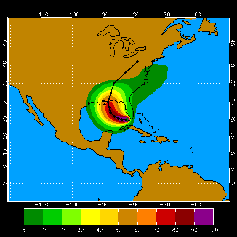
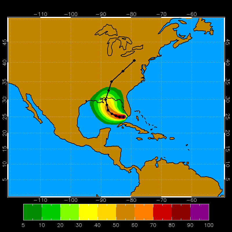
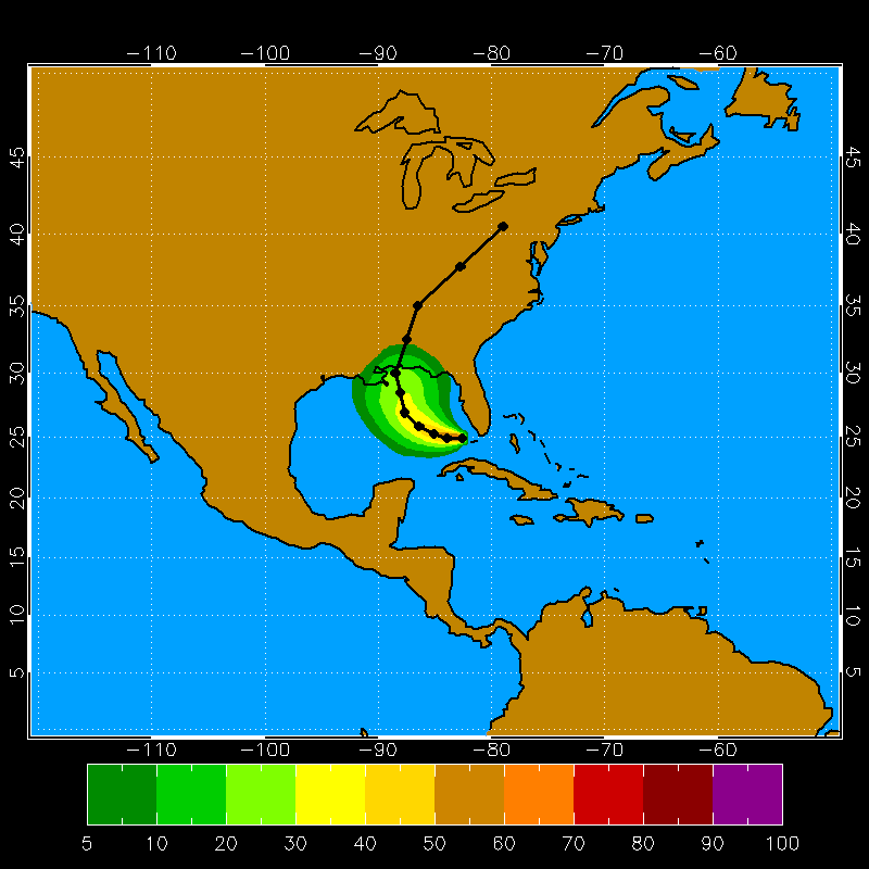
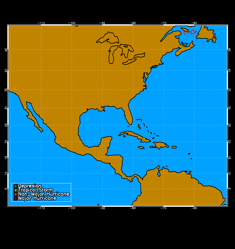
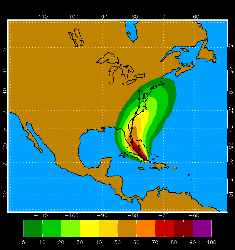
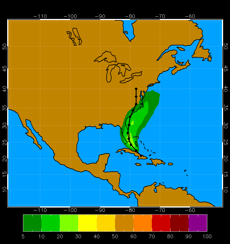
Tropical Storm Humberto Example 18 UTC 12 Sep 2007

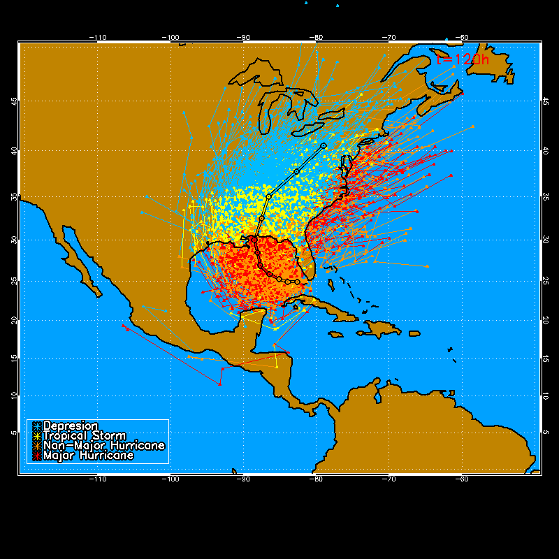
Animation of the tracks of the 1000 realizations at 12 hour intervals (upper), and the total tracks for the full length of the NHC forecast (lower). The NHC forecast track is also shown with a black outline.

The 0-120h cumulation proabilities of 34 (upper), 50 (middle), and 64kt (lower) winds.
Page Contact
Unless otherwise noted, all content on the CIRA RAMMB: VISIT, SHyMet and VLab webpages are released under a Creative Commons Attribution 3.0 License.